
Sofia Foladori Invernizzi
Monday, April 6, 2020
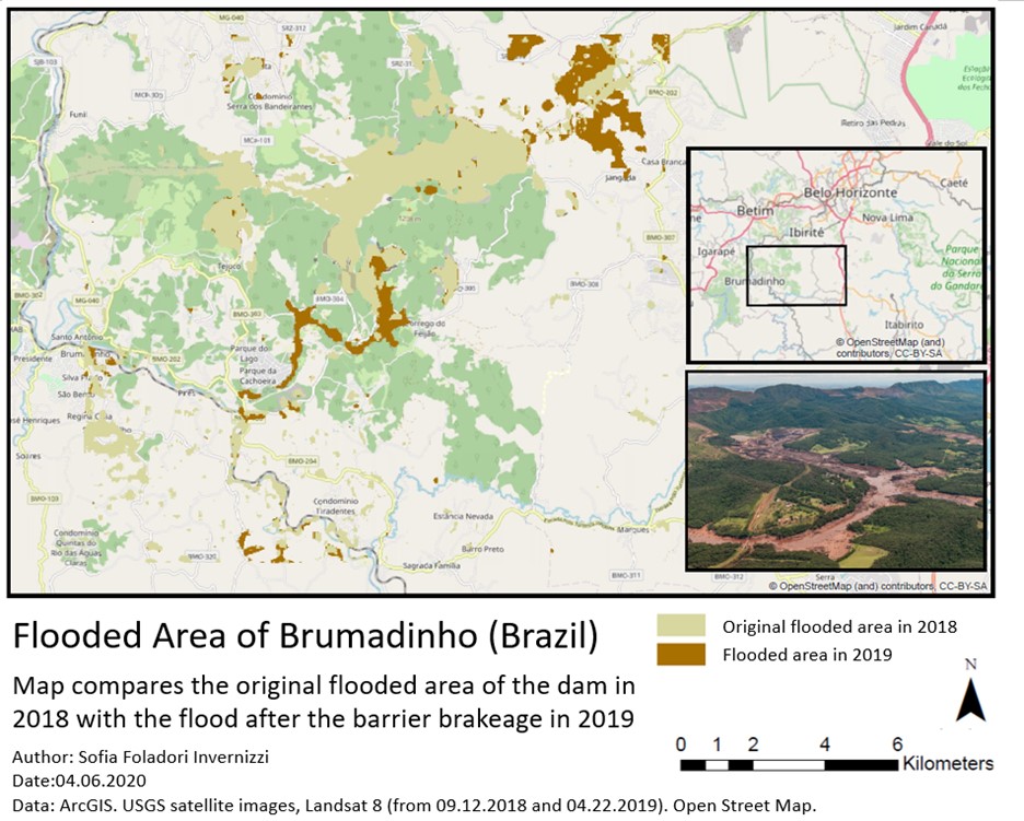
Flooded Area of Brumadinho (Brazil)
A map was done to compare the original flooded area of Brumadinho (Brazil) in 2018 due to the dam and the increase in the flooded extension after the breakage of the barrier in 2019, creating a giant environmental impact.
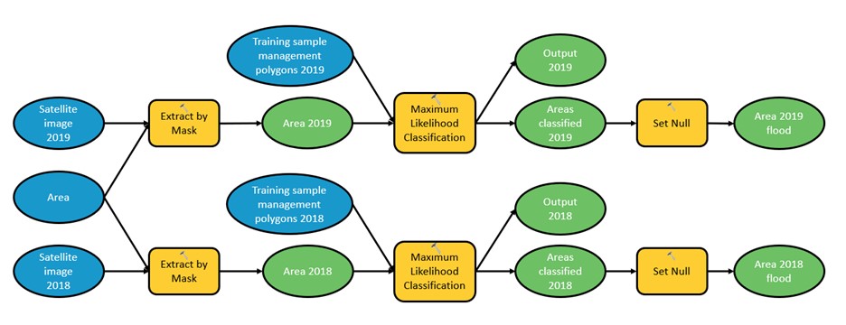
Workflow
Output
References
ArcGIS
USGS satalite images
Landsat 8 (from 09.12.2018 and 04.22.2019)
Open Street Map